

|
|
|
|
|
|||||||
| Home | Forums | Gallery | Webcams | Blogs | YouTube Channel | Classifieds | Register | FAQ | Members List | Donate | Today's Posts | Search |
 |
|
|
Thread Tools | Display Modes |
 01-11-2010, 09:07 PM
|
#1 |
|
Senior Member
Join Date: Jun 2007
Posts: 2,129
Thanks: 380
Thanked 1,016 Times in 345 Posts
|
Not sure if it is ok to post another site here, but thought it might be of some interest to the hiking folk. I found this site that has a zoomable map of the Ossipee trails. So here it is....
http://www.franklinsites.com/hikepho...itossipees.php |

|

|
|
01-11-2010, 09:35 PM
|
#2 |
|
Senior Member
Join Date: Jan 2005
Posts: 2,128
Thanks: 1,348
Thanked 564 Times in 291 Posts
|
Isn't the trail bandit the guy who cuts un-athorized trails through the mountains that often result in private landowners limiting access to their properties?
|
|
|
|
|
01-11-2010, 10:51 PM
|
#3 |
|
Senior Member
Join Date: Jun 2007
Posts: 2,129
Thanks: 380
Thanked 1,016 Times in 345 Posts
|
Hmmm this is interesting.....Sounds like the land tract was reopened to the public though. I better hike these trails quick. In case they close them again.
 http://www.franklinsites.com/hikephotos/Ossipee/ |
|
|
|
|
01-12-2010, 04:18 AM
|
#4 |
|
Senior Member

Join Date: Jan 2005
Location: Florida (Sebring & Keys), Wolfeboro
Posts: 6,003
Thanks: 2,265
Thanked 784 Times in 560 Posts
|
I inquired elsewhere about this region last October.
In one day, a really serious hiker can cover most of the peaks on the southern half of the Ossipees and end back at their car. The trails' beginnings start at what I figured was a clear-cut for "Castle in the Clouds II". (Not yet determined what the clear-cut is "about"). The Lake Winnipesaukee views are comprehensive, as shown from a half-dozen peaks whose nameslike "Big Ball"don't appear on maps!  (Or are misspelled, renamed, or unknown to people who live next to them). (Or are misspelled, renamed, or unknown to people who live next to them).  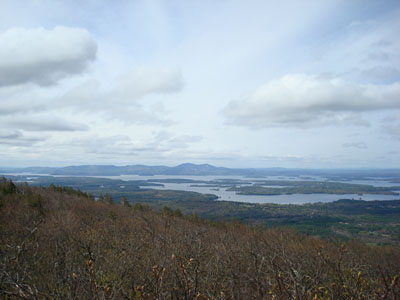 Here is a list of trail conditions, difficulty, elevations, and navigation: trails are marked with yellow flashes on handy boulders. http://www.franklinsites.com/hikepho...-2008-0510.php Crowds are listed as "minimal"I can't imagine why.  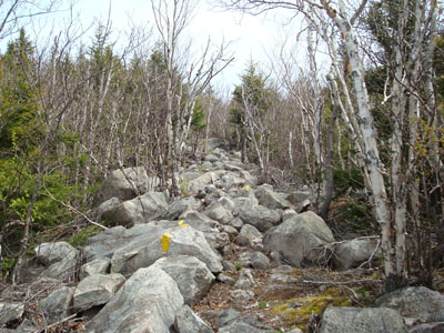
|
|
|
|
|
| Bookmarks |
|
|


 Linear Mode

