

|
|
|
|
|
|||||||
| Home | Forums | Gallery | Webcams | Blogs | YouTube Channel | Classifieds | Register | FAQ | Members List | Donate | Today's Posts | Search |
 |
|
|
Thread Tools | Display Modes |
 10-17-2010, 11:43 AM
|
#1 |
|
Senior Member

Join Date: May 2009
Location: Moultonboro
Posts: 519
Thanks: 185
Thanked 229 Times in 120 Posts
|
"On August 3, 1852 on Lake Winnipesaukee in NH, a crew race between Harvard and Yale was the very first intercollegiate athletic event in the US."
I had no idea...any other fun facts about the lake? |

|

|
|
10-17-2010, 12:47 PM
|
#2 |
|
Senior Member
|
In 1822, the Lakeport Dam was built in Laconia and it raised the Lake Winnipesaukee water level by about 18 feet. Prior to that, Lake Winnipesaukee was about seven or eight smaller lakes that were interconnected by a natural downstream flow of water from Lee's Mills to Moultonborough to Melvin Village to the broads to the Weirs, to Paugus Bay, to the Lakeport Dam in Laconia, and over the dam and into the Winnipesaukee River. A lot of water has gone over that dam since 1822! Lake Winnipesaukee contains about 75-billion gallons of very fresh water and is about 22 miles long.
Starting in the 1820's, using water power from the Lakeport Dam, Laconia used to be a world famous mill town that produced cotton material for clothing, and railroad cars/street cars for use in railroads/trolley systems around the U.S.
__________________
 .... Banned for life from local thrift store! .... Banned for life from local thrift store!
|
|
|
|
| The Following User Says Thank You to fatlazyless For This Useful Post: | ||
RailroadJoe (10-17-2010) | ||
|
10-17-2010, 01:12 PM
|
#3 | ||
|
Senior Member

Join Date: Nov 2003
Location: Central NH
Posts: 5,253
Blog Entries: 1
Thanks: 1,455
Thanked 1,357 Times in 476 Posts
|
Quote:
Please visit the History of the Lake Size thread. Quote:

|
||
|
|
|
| The Following 4 Users Say Thank You to Rattlesnake Gal For This Useful Post: | ||
|
10-17-2010, 06:09 PM
|
#5 | |
|
Senior Member

Join Date: Apr 2004
Location: Laconia, NH
Posts: 1,284
Thanks: 409
Thanked 155 Times in 40 Posts
|
Quote:

__________________
Never waste time lamenting what was. Simply celebrate what is!
|
|
|
|
|
| Sponsored Links |
|
|
|
10-17-2010, 09:08 PM
|
#6 |
|
Senior Member
Join Date: Oct 2002
Location: Hermit Cove
Posts: 354
Thanks: 20
Thanked 68 Times in 40 Posts
|
That was going to be my line!!! Great info RG! Did you say you saved all these maps since you were a little girl??

|
|
|
|
|
10-18-2010, 05:27 AM
|
#7 | |
|
Senior Member

Join Date: Jan 2005
Location: Florida (Sebring & Keys), Wolfeboro
Posts: 6,028
Thanks: 2,285
Thanked 789 Times in 564 Posts
|
Quote:
|
|
|
|
|
|
10-18-2010, 07:52 AM
|
#8 |
|
Senior Member

Join Date: Apr 2004
Posts: 5,075
Thanks: 215
Thanked 903 Times in 509 Posts
|
I DAMand that FLL be banned from posting facts.

__________________
SIKSUKR |
|
|
|
| The Following User Says Thank You to SIKSUKR For This Useful Post: | ||
Rattlesnake Guy (10-18-2010) | ||
|
10-18-2010, 08:26 AM
|
#9 |
|
Senior Member

Join Date: Oct 2004
Location: Laconia NH
Posts: 5,669
Thanks: 3,285
Thanked 1,132 Times in 814 Posts
|
At one time, there was a cleft in Lakeport that diverted the flow of water out of Alton to the sea. Pretty much the path of Merrymeeting River. The lake was much bigger then. Lily Pond in Gilford was part of the big lake.
When the cleft broke in prehistoric times, the lake settled to the current depth minus about 20 feet before the dam was built. Cattle Landing was named because it was shallow enough to walk cattle from the mainland to Bear island. When they built the dam, Endicott Rock would have been under water. It was moved from to its present location for all to enjoy as well as protect it from the weather. The dam was built by the mills in Lowell Mass to ensure they have plenty of water to power the mills at all time. The dam also benefits mills along the Merrimack River.
__________________
Someday may never be an actual day. |
|
|
|
|
10-18-2010, 09:21 AM
|
#10 |
|
Senior Member
|
Well, as the saying goes, a picture is worth a thousand words, and a map is very similar to a picture, so that makes a map an excellent source of information.
My basis for what I said was a vague recollection from a few years back found on a google search on the Lakeport Dam.....just off the top of my head as I was running late and heading out the door.....so definately some more dam research is needed here to investigate this hypothicized 18' height increase made by the 1822 building of the dam. Thankyou in advance Rattlesnake Gal.
__________________
.... Banned for life from local thrift store!
|
|
|
|
|
10-18-2010, 09:29 AM
|
#11 | |
|
Member
Join Date: Mar 2009
Posts: 32
Thanks: 28
Thanked 0 Times in 0 Posts
|
Quote:
__________________
As you slide down the banisters of life may the splinters never point the wrong way. |
|
|
|
|
|
10-18-2010, 10:36 AM
|
#12 |
|
Senior Member
|
Now, just hold on there a minute, because I still accurately claim that the Lakeport Dam, built in 1822, raised the water level by 18 feet.
This dam construction is the origin of Lake Winnipesaukee as it has existed from 1822 till today. When I say 1822, let me readjust that just a little to include the time period from 1822 till about 1827 as the time when the dam was built up to a height similar to its' existing size today. The dam changed everything on the lake. It changed it from a group of about 7 - 8 smaller lakes into one large lake, and I can back this up with some good reference research, but not right now. I got to get going and haven't got the time right now.........so.....later....alligator!
__________________
.... Banned for life from local thrift store!
|
|
|
|
| The Following User Says Thank You to fatlazyless For This Useful Post: | ||
RailroadJoe (10-18-2010) | ||
|
10-18-2010, 11:03 AM
|
#13 |
|
Senior Member
Join Date: Jul 2004
Posts: 658
Thanks: 121
Thanked 283 Times in 98 Posts
|
I once heard that the old horse boats and barges used to be beached up in the top of Braun Bay late in the year. The Lake level then went down and they spent the winter there, ice free.
There is some small wreckage by the no rafting zone which I found as a kid. For the life of me it looks(ed) like the side cabins of a horse barge. Maybe it's just a couple of bob houses or out houses. 'Don't know. It's a fun swim. About eight feet of H2O. In a line between the little cove at the top of the bay and the little cottage on the point on the east side of the cove. About 300 feet from the east shore. Misty Blue |
|
|
|
|
10-18-2010, 12:12 PM
|
#14 | ||
|
Senior Member

Join Date: Jul 2002
Location: Massachusetts
Posts: 338
Thanks: 0
Thanked 250 Times in 83 Posts
|
Quote:
Quote:
Last edited by Bizer; 10-23-2010 at 08:11 AM. |
||
|
|
|
| The Following User Says Thank You to Bizer For This Useful Post: | ||
RI Swamp Yankee (10-18-2010) | ||
|
10-18-2010, 12:58 PM
|
#15 | |
|
Senior Member

Join Date: Jul 2002
Location: North Kingstown RI
Posts: 688
Thanks: 143
Thanked 83 Times in 55 Posts
|
Quote:
 .. ..
__________________
Gene ~ aka "another RI Swamp Yankee" |
|
|
|
|
|
10-18-2010, 02:31 PM
|
#16 | |
|
Senior Member
Join Date: Apr 2004
Posts: 5,075
Thanks: 215
Thanked 903 Times in 509 Posts
|
Quote:
__________________
SIKSUKR |
|
|
|
|
|
10-18-2010, 02:55 PM
|
#17 |
|
Senior Member
Join Date: Apr 2004
Location: NH
Posts: 2,689
Thanks: 33
Thanked 439 Times in 249 Posts
|
I think we should remember that without a dam the level of the lake was far from the stable values we have today. Today the lake varies less than 2 feet over the year. Without a dam the level would vary much more.
Maybe during dry years or at the end of summer, the channel between the main lake and Paugus bay got very shallow. We've all seen the drawings of Indians trapping fish there in the original wiers. As the lake water dropped below the bottom of the channel the lake had no exit, so it would fill until the level rose. There maybe other areas with similar natural dams. I doubt very much the average lake level was 18 feet lower in 1822, there is too much contrary eveidence, and FLL never backs his "facts". But I could believe that the water varied 18 feet in those years, between spring flooding and a very dry fall. I have no facts just my guesses. |
|
|
|
|
10-18-2010, 05:17 PM
|
#18 |
|
Senior Member

Join Date: Nov 2007
Location: Effingham
Posts: 408
Thanks: 37
Thanked 19 Times in 15 Posts
|
I believe FLL always has his dam facts correct and we should all take his words as gospel.
")
|
|
|
|
|
10-18-2010, 07:21 PM
|
#19 |
|
Senior Member
Join Date: Jun 2008
Location: Portsmouth. RI
Posts: 2,231
Thanks: 400
Thanked 460 Times in 308 Posts
|
If we had had the environmentalist whackos we have today..back in 1822, the lake would be just a few "Duck Puddles" now. Just sayin
 NB NB
|
|
|
|
|
10-18-2010, 07:59 PM
|
#20 |
|
Senior Member

Join Date: Nov 2002
Location: The Lakes, Central NH. and Dallas/Fort Worth TX.
Posts: 3,694
Blog Entries: 3
Thanks: 3,067
Thanked 472 Times in 236 Posts
|
Credit Wikipedia...
http://en.wikipedia.org/wiki/Lake_Winnipesaukee Terry __________________________________________
__________________
trfour Always Remember, The Best Safety Device In The Boat, or on a PWC Snowmobile etc., Is YOU! Safe sledding tips and much more; http://www.snowmobile.org/snowmobiling-safety.html |
|
|
|
|
10-18-2010, 09:52 PM
|
#21 |
|
Senior Member
|
From memory, I recall the winni divers guy saying that the old shoreline is visable underwater and is eighteen feet down below. So, it's right there, down there, 18' down below, etched into the underwater terrain, for all to see. Suggest you take a deep breath and go jump in the lake tomorrow to investigate.....ha ha....only kidding.....will check it out myself and report back with some prima facia evidence on b&w film and post it here!
!www.lakeportnh.org www.weirsbeach.com/topten/reason9frame.html www.winnipesaukee.co/forums/showthread.php?t=931 Ok...listen up....tomorrow at 9-am, there will be a 100-question pop quiz on these three Lakeport Dam related websites. Any results lower than an 80 get you flunked plus you'll have to go find the same number as your flunking grade in cigarette butts from off of the beach at Weirs Beach! That means.....receive a 78....you need to produce 78 grubby cigarette butts.....understand!
__________________
.... Banned for life from local thrift store!
Last edited by fatlazyless; 10-18-2010 at 10:37 PM. |
|
|
|
|
10-19-2010, 02:29 PM
|
#22 |
|
Senior Member
Join Date: Apr 2004
Posts: 5,075
Thanks: 215
Thanked 903 Times in 509 Posts
|
In that case I'm going to answer every question wrong and score a zero. I think you have this test reward backward as well.
__________________
SIKSUKR |
|
|
|
|
10-19-2010, 02:39 PM
|
#23 |
|
Senior Member
Join Date: Apr 2004
Posts: 5,075
Thanks: 215
Thanked 903 Times in 509 Posts
|
Here's what I dug up on Google from our own R-Girl on this very forum. The relevant part is highlighted in red. Sounds right to me based on the Weirs channel depth now. In fact, if you read the link http://www.winnipesaukee.com/forums/...read.php?t=931 to the thread I got this from, McDude supplies a document that claims the lake was in fact 35 feet higher at some point. Good stuff to digest. Thanks RG and McDude.
History of the Lake Size -------------------------------------------------------------------------------- The topic of our lake having been nine separate bodies of water at one time was intriguing, but baffling. Here is what the Lake Winnipesaukee Historical Society reports on the subject. LAKE WINNIPESAUKEE In The Beginning... Since the orbit and speeds of the earth were stabilized over four billion years ago, an extremely complex series of surface changes has occurred that are still taking place. Between various times and stages of relatively peaceful existence, like our present, cataclysmic events have upset our land: monsterous earthquakes beyond conception, mountain and canyon forming upheavals in never to be recorded numbers, receding oceans and seas giving place to miles of depth of erosives and lava and ashes only to be replaced by other bodies of water, vast areas of volcanic action time and time again, Sahara-like deserts and post-glacial silt and sand barrens with storms beyond comprehension, and recently - several glacial periods; all of these and many more. The landscape as we see it today is primarily as it was prior to the start of the last glacial period of about 50,000 years ago, plus the eskers, drumlins, boulder trains, cirques, kames, varves and other glacial remains. Few rocks that we can easily study are older than 350 millions of years (from the Cambrian and Ordovician parts of the Paleozoic Era). Some may be of Silurian date, since the oldest; but most have evolved from the igneous, metamorphosed, and sedimentary rocks during and since the Devonian time. Since the end of the Wisconsin Glacial Stage (nearly 14,000 years ago) in our present Cenozoic Era, topographic chn have been few and barely noticeable. Here in our region there are no fossils (these are limited to the Littleton area), but many other geologic features are of interest: the meltwater channel which is Valley Street (Lakeport), the boulder trains from Red Hill socialite-nepheline-syenite and Ossipee Mts. Moat-volcanics and Conway-granite (reaching into the Atlantic), the world's most famous ring-dike formation of the Ossipee Mts., Rattlesnake Is. which is geologically part of the Belknap Mts., the huge water-shed boulder in the CoppleCrown Mts., the volcanic-vent on Mt. Belknap, and others. Your favorite library, rock-shop, or the N. H. Development Comm. will gladly help you with locations; but some of the books have misinterpreted the facts. For the rock collector, mines and minerals in this region are limited to the iron deposit on Gunstock Mt., the sulphide prospects (gold, lead, zinc, etc.) off the Parade Rd., the quartz crystals on Ladd Hill (with a most magnificent view), the garnet sand of Paugus and Saunders Bays, the amethyst, sand of Long Is., Conwaygranite pockets in the Belknaps, the clay and quartz at the foot of Brickyard Mt., fluorescent socialite of Red Hill, crystals of the Ossipees, and very few others. FORMATION OF WINNIPESAUKEE Surficial and Bedrock Geology studies of New Hampshire indicate that prior to the Ice Age there was no lake here as we know it today. The quartz diorite (the primary rock of the Winnipesaukee basin) was decomposed in place before and during the glacial period, and the power of the ice toward the end of the Pleistocene Epoch gouged out the loosened rock leaving hundreds of hills which are our picturesque islands in a hauntingly enticing water-world. Geologists point out that the water level of this lake has remained about the same as today. Studies of the hillsides, streams, meltwater channels; intervales, and varved deposits preclude the possibility of any glacial dams or deep waters such as Lake Hitchcock that once filled the present Connecticut R. valley. The conclusion is that the Winnipesaukee River of 1969 is very nearly the same drainage channel that the lake has always had. THE LAKE This "Beautiful Water of the High Place" has always been held in very high esteem since primitive man first came to its scenic shores. Known as Winnipisseoke, or Winnipiseogee Pond, and dozens of others very similar, the present Winnipesaukee name was made official by the New Hampshire legislature of 1933. With 183 miles of shoreline, an area of 71.8 square miles (45,952 acres), dimensions at 91/2 miles wide by 21 miles long, an altitude of 504 feet, and a flotilla of islands often estimated at 365, our Lake ranks very high among the world's inland waters. It is the largest of nearly 1311 ponds and lakes in 9,302 square mile New Hampshire. The depth of 169 feet of water lies beneath your boat South-East of Rattlesnake Island, with most of the Lake resting between 20 and 100 feet deep. The elevation is changed by the annual Spring runoff and by an occasional drought (in 1941 the lake contained approximately 14,600,000,000 less cubic feet of water than normal, and in 1826 it may have been even lower). Before man dammed the falls at Lakeport over a 150 years ago, the level was more than three to five feet below the present. Prior to 1832 the Weirs channel was ' a shallow way, and a short "river", before the advent of down stream damming,. of about a three foot drop over a possible width of 150 feet, until the 1803 bridge was built. Lake Winnipesaukee was marked in 1899 with the first inland waterway bouts in the United States, over 300 hazards being indicated, with the present number of markers, .light-bouys, and other navigation aids about 600. Over 60 streams run into the Lake, from small hillside brooks to the short Hill River system in the North and the narrow Merrymeeting River of the South.. Several dozen small lakes and ponds drain into Winnipesaukee. It may never be known how such a large and wholesome lake can maintain itself from such a confined watershed. In 1811 a charter was granted for a canal from Alton Bay to the Sea by way of Merrymeeting, Cocheco, and Piscataqua rivers. Though the Little Pequakit Canal Co. came into being in 1819, no work was done on a proposed project that was intended to eventually extend from the Atlantic Ocean through our Lake, to Squam Lake, and the Connecticut River, and on to Lake Champlain and the St. Lawrence. Full article from Lake Winnipesaukee Historical Society
__________________
SIKSUKR |
|
|
|
| The Following 2 Users Say Thank You to SIKSUKR For This Useful Post: | ||
Grant (10-19-2010), GsChinadoll (10-22-2010) | ||
|
10-19-2010, 04:10 PM
|
#24 | |
|
Senior Member

Join Date: Jul 2002
Location: Pennsyltuckey, Tuftonboro, Moultonborough
Posts: 1,510
Thanks: 387
Thanked 234 Times in 128 Posts
|
Quote:
__________________
"When I die, please don't let my wife sell my dive gear for what I told her I paid for it." |
|
|
|
|
|
10-19-2010, 07:07 PM
|
#25 |
|
Senior Member
|
I expect to be in Laconia tomorrow, and will go knock on the door of the dam keeper, Bob Fay, (any relation to widely known Merrill Fay of Fay's Boatyard) and ask him if he has any historical-educational info on this subject. Who knows, maybe the Lakeport Dam gets to hold visits from NH junior high school science classes and the dam is equipped with a dam information sheet. Isn't the Lakeport Dam run and administered by the New Hampshire Dept of Environmental Services so it seems plausible they could have an informational pamphlet for educational purposes.
If I get the chance, I'll ask him: How high is the water level behind the dam? What's his guess as to the increase in water height the dam adds to the lake there in Paugus Bay, and in the larger waters above the Weirs channel? Does he ever get bored and fall asleep while sitting around all day, and watching the water pour over the dam? ....just kidding about that one....let's see....what else can I ask that is at least a little bit intelligent.....how about inquiring about a history of the different dams at this location over the last 350-years.....and has the City of Laconia's Assessing Dept placed a monetary value on the dam....even though it most likely pays no property taxes to Laconia as it belongs to the State of New Hampshire? Dam straight on that last item, ayuh!
__________________
.... Banned for life from local thrift store!
|
|
|
|
|
10-22-2010, 02:13 PM
|
#26 |
|
Senior Member
Join Date: Nov 2003
Location: Central NH
Posts: 5,253
Blog Entries: 1
Thanks: 1,455
Thanked 1,357 Times in 476 Posts
|
1766 The areas first sawmill was built at The Weirs, (not at Lakeport) followed by a corn mill and brickyard.
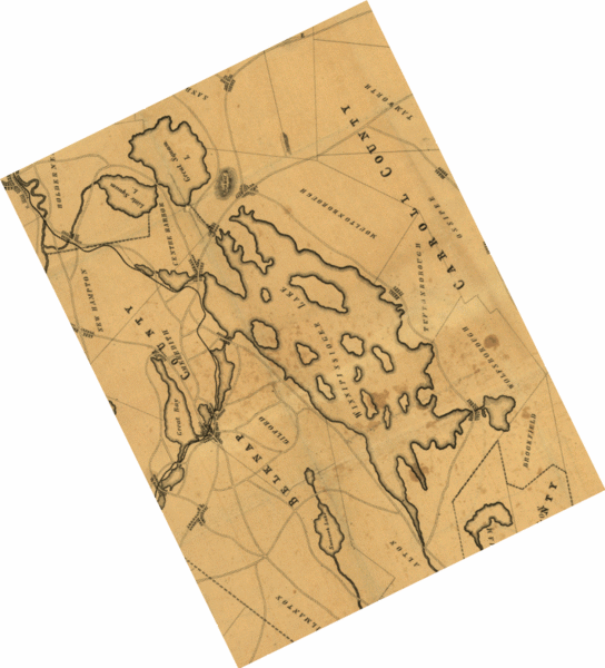
There was not enough drop at the channel, so the mills fell to disrepair even before any dam existed at Lake Village. 1766 Abraham Folsom built his homestead in the Elm Street area of Lakeport. 1780 The town of Gilmanton voted to sell a couple of their lots to him to encourage his business operations. 1781 Folsom built a dam across the river at what is now called Lakeport to power his first grist mill, later adding a sawmill. 1788 Both of Folsom's mills burned, but future sawmills functioned here until 1861. Gristmills until destroyed by fire in 1903. 1818 Gilford sold the mill privilege on the Gilford side of river to Johnathan Nelson - instructing him to leave passage for fish. 1825 Nathan Batchelder acquired Folsom's farm and mill operations, effectively purchasing the right to control the level of the lake. 1826 Batchelder, in association with Stephen Lyford, a lawyer, built a new loose boulder and rubble dam about 16.5' below the Folsom dam, that can still be seen just above the bridge. Arrangements for a stone canal were also made to allow for navigation. 1833 Nathan Batchelder sells his interests to Governor's Island residents, Nathaniel Davis and David Pingree, who were acting as agents for Winnepissiogee Lake Cotton and Woolen Manufacturing Company. This company was not in New Hampshire to to manufacture wool or cotton. The stock in this company was all held by Essex Company of Lawrence and the Locks and Canal Company of Lowell, Massachusetts. Their intent was to control the level of Lake Winnipesaukee for the benefit of factories downstream and out of state. The excessive logging along the Pemigewasset watershed caused this tributary of the Merrimack River to run almost dry in the summer, which turned Lake Winnipesaukee into the only feasible solution. 1851 the "Lake Company" erected a more extensive stone dam to increase the reservoir capacity of the lake, enabling the company to draw it down to provide extra power when the Massachusetts mills demanded it. The top of this dam was only slightly higher than Batchedler's, but it was built tighter and was considerably more effective. The lake level rose significantly, completely altering the huge lake, by flooding a vast amount of shoreline. Anticipating that the waterfront owners would not appreciate such manipulation of the lake, the company attempted to buy as much frontage as possible. The farmers that owned lake-shore property were especially furious with being flooded and brought lawsuits against the company. This eventually forced the "Lake Company" to give up and sell most of its Lakes Region holding. The state later established the Water Resources Board and assumed responsibility for the control of the water level of Lake Winnipesaukee on behalf of the public. The Witches once an island proper until the raising of the waters because of the dam. (Purchased in 1830 by the "Lake Company".) 1912 Someone discovered that a map made by a civil engineer for Fullerton Wells' Island Company included many islands that had not existed since the dam had been built in 1851.  From the McDude Gallery Sources of information: The Gunstock Parish by Adair Mulligan Lake Winnipesaukee by Bruce Heald Weirs Beach historic information and dam pictures. (Scroll down.) (They seem to be mistaken on this website on the 1766 date of the Lakeport dam.) Last edited by Rattlesnake Gal; 10-22-2010 at 05:22 PM. |
|
|
|
| The Following 3 Users Say Thank You to Rattlesnake Gal For This Useful Post: | ||
|
10-22-2010, 02:16 PM
|
#27 | |
|
Senior Member
Join Date: Nov 2003
Location: Central NH
Posts: 5,253
Blog Entries: 1
Thanks: 1,455
Thanked 1,357 Times in 476 Posts
|
Quote:
Perhaps it should have read below or from the bridge?  Lakeport Dam 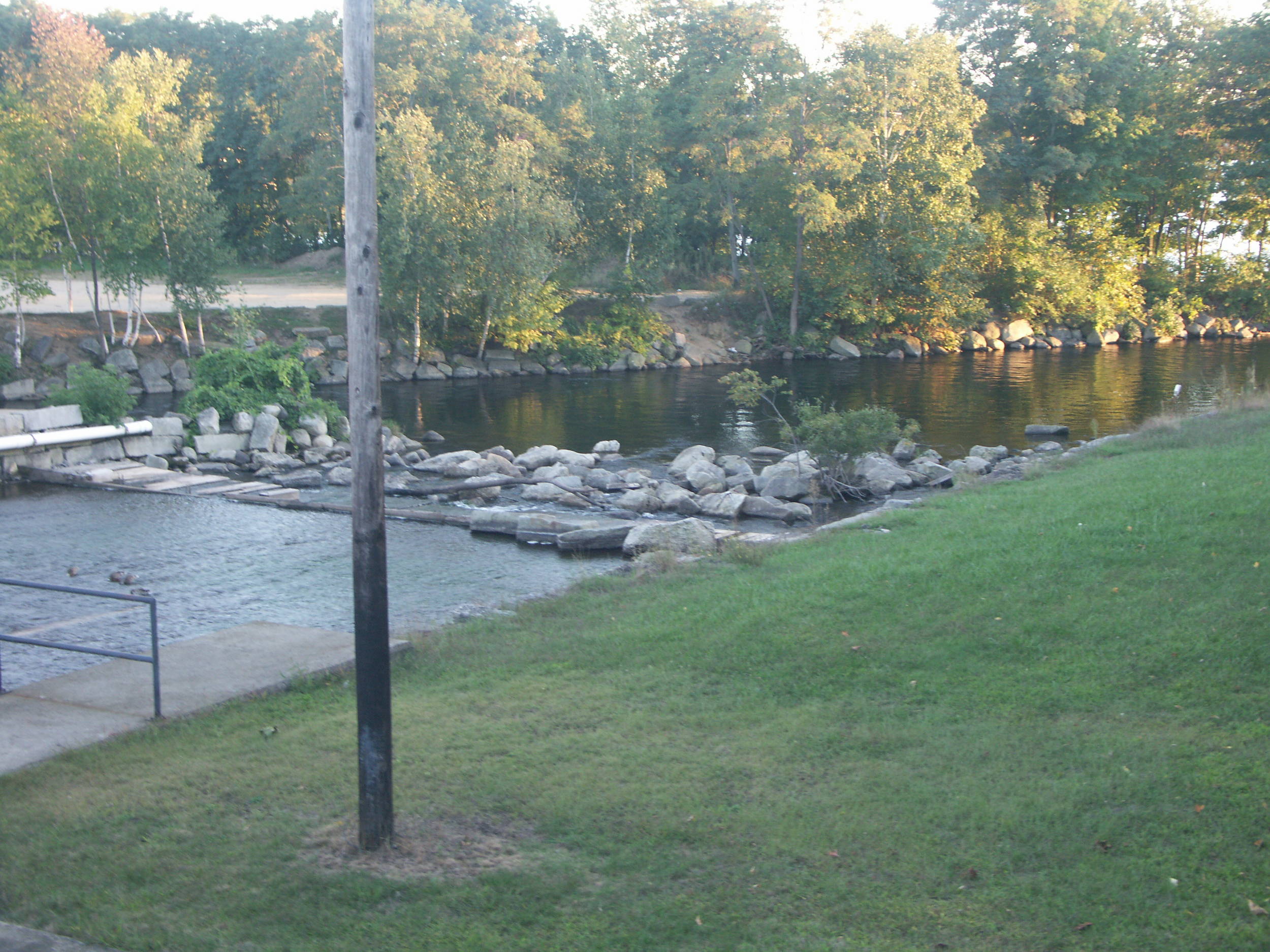 Below the Lakeport Dam 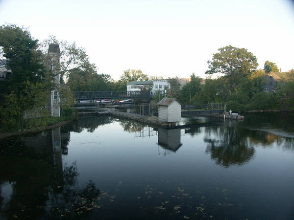 Or is this to what they refer? Above the Lakeport Dam Last edited by Rattlesnake Gal; 10-22-2010 at 03:49 PM. |
|
|
|
|
| The Following User Says Thank You to Rattlesnake Gal For This Useful Post: | ||
fatlazyless (10-23-2010) | ||
|
10-22-2010, 03:11 PM
|
#28 | |
|
Moderator

|
Quote:
According to Bizer, these are the 5 largest islands on the lake in alphabetical order: Bear, Cow, Governors, Long, Rattlesnake Can you put them in the correct order, largest to smallest? Answer below. Long=1186 (acres); Bear=780; Cow=522; Governors=504; Rattlesnake=368 Anyone else surprised by the answers? |
|
|
|
|
|
10-22-2010, 04:26 PM
|
#29 |
|
Senior Member
Join Date: Jul 2004
Posts: 658
Thanks: 121
Thanked 283 Times in 98 Posts
|
Grant:
I too have never seen any sign of "man" which would indicate a shoreline in 15feet of water. But we did find... A dear old pal of mine (and member) and I were snorkeling around Glines Island about ten years ago and found a most interesting structure. A fire pit. Yup, a fire pit in about five feet of water about 30-40 feet off of the western shore of the island. This thing was not an accident. I had to be purposely made. It was (is) old. Now maybe someone decided to build a fire pit underwater or maybe it is not a fire pit at all but had some other purpose. I don't know. But if I were to guess I would say that if the Lake were five feet lower it would make a great SHORE SIDE fire pit. Misty Blue. |
|
|
|
| The Following 3 Users Say Thank You to Misty Blue For This Useful Post: | ||
|
10-22-2010, 06:30 PM
|
#30 | |||
|
Senior Member
Join Date: Nov 2003
Location: Central NH
Posts: 5,253
Blog Entries: 1
Thanks: 1,455
Thanked 1,357 Times in 476 Posts
|
Quote:
Quote:
Quote:
Lake Winnipesaukee Watershed |
|||
|
|
|
|
10-23-2010, 12:55 PM
|
#31 | |
|
Senior Member
Join Date: Jul 2002
Location: North Kingstown RI
Posts: 688
Thanks: 143
Thanked 83 Times in 55 Posts
|
Quote:
http://www.winnipesaukee.com/forums/...ead.php?t=4347
__________________
Gene ~ aka "another RI Swamp Yankee" |
|
|
|
|
| The Following User Says Thank You to RI Swamp Yankee For This Useful Post: | ||
Rattlesnake Gal (10-25-2010) | ||
|
10-25-2010, 12:31 PM
|
#32 |
|
Senior Member
Join Date: Nov 2003
Location: Central NH
Posts: 5,253
Blog Entries: 1
Thanks: 1,455
Thanked 1,357 Times in 476 Posts
|
Lake Winnipesaukee was a warm water fishery until about 1860, with yellow perch, chain pickerel, brown bullheads, shad, cusk, round and lake whitefish, brook and lake trout and alewife are to name a few.
Shad, not salmon were the fish that were trapped at The Weirs with weirs by the Native Americans. Atlantic salmon and American shad traveled up the Merrimack River for spawning in the spring. The salmon took a left in Franklin and went on to the White Mountains via the Pemigewasset River. The shad took a right to the Winnipesaukee River. Some sixty to seventy species of fish have been introduced into Lake Winnipesaukee through the last 150 years. Land locked salmon did not appear until the late 1870s. They were introduced by the hatchery in Meredith and came from the St. Croix and Penobscot Basins in Mane. Small and largemouth bass, rainbow and brown trout are some of the many fish, which were stocked. Either by individual fishermen or the state agencies, which significantly altered the Lake Winnipesaukee native fishery. |
|
|
|
|
10-25-2010, 02:11 PM
|
#33 |
|
Senior Member
Join Date: Jul 2002
Location: Pennsyltuckey, Tuftonboro, Moultonborough
Posts: 1,510
Thanks: 387
Thanked 234 Times in 128 Posts
|
Wow -- thanks for all the great info.
This could be one of my favorite threads of all time.
__________________
"When I die, please don't let my wife sell my dive gear for what I told her I paid for it." |
|
|
|
|
10-26-2010, 04:15 PM
|
#34 |
|
Senior Member
Join Date: Nov 2003
Location: Central NH
Posts: 5,253
Blog Entries: 1
Thanks: 1,455
Thanked 1,357 Times in 476 Posts
|
The Merrimack River: Its Source and its tributaries, by By J. W. Meader. 1869
Page 100 The lake abounds in fish of many varieties; the lake trout and the pickerel being the most important and valuable. Cusk are much prized by many, and perch and horned-pout may be taken at any time, by the most inexperienced angles, in quantities to suit. A variety of salt-water fish were some years since placed in this lake by experimenting parties; but as nothing was seen or know of them afterwards, it was presumed they found their level either in a watery grave, or through the channel of the Winnipesaukee and the Merrimack in a more congenial element, the briny deep. |
|
|
|
|
10-26-2010, 04:27 PM
|
#35 |
|
Senior Member
Join Date: Nov 2003
Location: Central NH
Posts: 5,253
Blog Entries: 1
Thanks: 1,455
Thanked 1,357 Times in 476 Posts
|
Winnipesaukee is an Indian name, and is derived from winne (beautiful), nipe (water), and kees (high), and auke (a place); and the Indian tribe that inhabited the territory adjacent to the lake took the name, the Winnipesaukee, as well as the lake itself, - Beautiful water of the high place.
Another interpretation has frequently been given to this word, which, entirely inaccurate, is yet exquisitely beautiful, and has, no doubt, been suggested by its eminent appropriateness: The smile of the Great Spirit. Emphatically a smile, equally to the Indian and the white man, of the Great Spirit, this lovely lake has been. Also an excerpt from: The Merrimack River: Its Source and its tributaries, by By J. W. Meader. 1869 |
|
|
|
|
10-27-2010, 05:13 PM
|
#36 | |
|
Senior Member
Join Date: Nov 2003
Location: Central NH
Posts: 5,253
Blog Entries: 1
Thanks: 1,455
Thanked 1,357 Times in 476 Posts
|
Quote:
Rattlesnake Island is much taller than all the other islands and if you use this Land to Acre Conversion Calculator, it comes up with a certain number. This doesn't seem to take into account the height of the land. Am I just confused? More Commonly Known Fun Facts: Rattlesnake Island is the tallest island in the lake. According to Bruce Heald's book, Lake Winnipesaukee, it is 390' above lake level. Lake Winnipesaukee is 504' above sea level. Last edited by Rattlesnake Gal; 10-27-2010 at 07:05 PM. |
|
|
|
|
|
10-27-2010, 05:49 PM
|
#37 |
|
Senior Member
Join Date: Oct 2004
Location: Laconia NH
Posts: 5,669
Thanks: 3,285
Thanked 1,132 Times in 814 Posts
|
LOL!
Many folks did not know that Rattlesnake Island is part of the Belknap Mountain range. Eons ago it was a volcano like the Ossipee Mountain range. 
__________________
Someday may never be an actual day. |
|
|
|
|
10-27-2010, 07:03 PM
|
#38 | |
|
Senior Member
Join Date: Nov 2003
Location: Central NH
Posts: 5,253
Blog Entries: 1
Thanks: 1,455
Thanked 1,357 Times in 476 Posts
|
Quote:
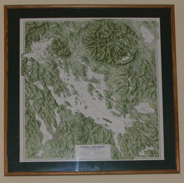 This, great for framing Duncan Press Central Lakes Region Map clearly shows both the Ossipee and Belknap volcanic ring dikes. Notice that Rattlesnake, Ship, Moose and Sleepers Islands seem to be part of this ring.  NH Geology: The Ossipee Mountain Ring Dike Complex (Scroll down.) This relief map can be purchased at The Old Country Store in Moultonborough.  The Ossipee Mountain “Ring Dike” |
|
|
|
|
|
10-27-2010, 07:58 PM
|
#39 |
|
Senior Member

Join Date: Nov 2004
Location: Bear Island
Posts: 642
Thanks: 349
Thanked 145 Times in 77 Posts
|
Can the general public climb the hill on Rattlesnake Island?
A neighbor of mine has done it a few times but I think she was friends with an owner on Rattlesnake. Thanks.
__________________
Dream out loud. |
|
|
|
|
10-28-2010, 07:56 PM
|
#41 | |
|
Senior Member

Join Date: Sep 2004
Posts: 1,254
Thanks: 423
Thanked 366 Times in 175 Posts
|
Quote:
|
|
|
|
|
| The Following User Says Thank You to Rattlesnake Guy For This Useful Post: | ||
Rattlesnake Gal (10-29-2010) | ||
|
10-29-2010, 01:46 PM
|
#42 |
|
Senior Member
Join Date: Apr 2004
Posts: 5,075
Thanks: 215
Thanked 903 Times in 509 Posts
|
Anybody else find it humerous that the RG's are responding to each other in this thread while probably sitting a few feet apart?
__________________
SIKSUKR |
|
|
|
| The Following User Says Thank You to SIKSUKR For This Useful Post: | ||
Rattlesnake Guy (10-29-2010) | ||
|
10-31-2010, 07:54 PM
|
#43 |
|
Senior Member
Join Date: Nov 2003
Location: Central NH
Posts: 5,253
Blog Entries: 1
Thanks: 1,455
Thanked 1,357 Times in 476 Posts
|
According to the Lake Winnipesaukee Historical Society,
Winnipesaukee contains 274 inhabitable islands of which only 132 are one-quarter acre. Click here for the very interesting full list. It is interesting that there are: 2 - Birch IslandsAlso, interesting that many are named for animals, fish, a reptile and an arachnid BadgerThere are four islands named after loons and not a single one named for our very abundant deer!  From the Gallery of baja-mamma Next year I hope we can get pictures for Winnipesaukee.com's PhotoPost Gallery for many of our islands. (Notice how many I couldn't find photos for.) Giving them good descriptions for those of us who might be using the search feature for threads like this.
|
|
|
|
| The Following User Says Thank You to Rattlesnake Gal For This Useful Post: | ||
jkjoshuatree (10-31-2010) | ||
|
10-31-2010, 10:31 PM
|
#44 |
|
Senior Member
Join Date: Nov 2004
Location: Bear Island
Posts: 642
Thanks: 349
Thanked 145 Times in 77 Posts
|
That's it. That's all I wanted to say. RG Rocks!!!
Thanks so much for the post!! Great idea about the island pics!!! I can cover Bear Island (St. John's Church, the Old Hotel Foundation, the Mail Dock, Sunset Rock, Camp Nakomis, Camp Lawerence,, etc.) Now I have a project for next year.
__________________
Dream out loud. |
|
|
|
| The Following User Says Thank You to jkjoshuatree For This Useful Post: | ||
Rattlesnake Gal (11-01-2010) | ||
|
11-01-2010, 01:37 PM
|
#45 |
|
Senior Member
Join Date: Nov 2003
Location: Central NH
Posts: 5,253
Blog Entries: 1
Thanks: 1,455
Thanked 1,357 Times in 476 Posts
|
Next spring I will definitely start a thread for island pictures.
There's a lot of islands capture and I welcome the help to get pictures of them all. If anyone is out this winter on sleds, some winter pictures would be great too - of the islands and perhaps the towns from the ice. That is something a lot of us never get to see. It hit me last night that the list from LWHS may not be 100% accurate. They list Hen and Gypsy, which is only one island, as well as Goose Egg Rock and Rocky, which is only one island too.  Did anyone else notice any others with the same situation? If you all would, can you take a look at the list and the area of the lake you frequent? Are all the islands you know of listed? Thanks! Bizer is also looking for island names - let's help him out! |
|
|
|
|
11-01-2010, 07:09 PM
|
#46 |
|
Senior Member
Join Date: Nov 2004
Location: Bear Island
Posts: 642
Thanks: 349
Thanked 145 Times in 77 Posts
|
...I make a few trips up during the winter and can definitely take some pictures of Meredith from the ice and possibly Centre Harbor as well.
As far as names, I think Jay Island would be perfect!!
__________________
Dream out loud. |
|
|
|
|
11-08-2010, 03:51 PM
|
#47 |
|
Senior Member
Join Date: Nov 2003
Location: Central NH
Posts: 5,253
Blog Entries: 1
Thanks: 1,455
Thanked 1,357 Times in 476 Posts
|
Excerpt from Let Me Show You New Hampshire, by Ella Shannon Bowles. 1938
The Dangerous reef Witch Rocks is still to be reckoned with when navigating boats between The Weirs and the southern and eastern parts of the lake. Everything possible is done to aid pilots. In 1899 the New Hampshire Legislature authorized the placing of buoys on rocks and reefs in the lake. Today the Public Service Commission has marked three hundred hazards in Winnipesaukee by means of flashing electric lights, steady lanterns, and spar buoys. But the Great Lake is not the only one marked, for buoys are kept up on twenty-three bodies of fresh water where boating is a pastime. All motor boats and outboard motors are licensed and the fees are used to maintain buoys already up and to mark new places in other lakes. Last year 3,424 craft on ninety-six of New Hampshire's lakes, ponds, and streams were licensed, and as the fee for each is three dollars, you can figure the sum out for yourself. |
|
|
|
| The Following User Says Thank You to Rattlesnake Gal For This Useful Post: | ||
Jonas Pilot (11-08-2010) | ||
|
| Bookmarks |
|
|


 Linear Mode

