

|
|
|
|
|
|||||||
| Home | Forums | Gallery | Webcams | Blogs | YouTube Channel | Classifieds | Register | FAQ | Donate | Members List | Today's Posts | Search |
 |
|
|
Thread Tools | Display Modes |
|
|
 08-20-2008, 08:45 AM
|
#1 | |||
|
Senior Member

Join Date: Jan 2005
Location: Florida (Sebring & Keys), Wolfeboro
Posts: 5,951
Thanks: 2,223
Thanked 781 Times in 557 Posts
|
Quote:
 Quote:
The bottom kept jumping into view repeatedly on one occasion, but I was sure I'd left those shoals behind. Shortly afterwards, I discovered that the bright sun was reflecting off the white jib, then being re-reflected off the water that made those huge "boulders" rise up to the surface!  What a relief! What a relief! Quote:
http://www.winnipesaukee.com/forums/...7&postcount=13
__________________
Is it  "Common Sense" isn't. "Common Sense" isn't. ")
|
|||

|

|
|
08-20-2008, 03:24 PM
|
#2 | |
|
Senior Member

Join Date: Sep 2003
Posts: 1,943
Thanks: 23
Thanked 111 Times in 51 Posts
|
Quote:
There are other places that are, right now, navigational hazards that could, if "we" really wanted to, be converted into recreational mooring fields / rafting areas. With less free shoreline it might be fun and necessary to exploit them. Maybe we could get Bizer to issue super detailed charts of these areas with GPS waypoints for safe passage routes in between the rocks. I'll bet the fishermen already know such routes. Perhaps the next time (  ) sa meredith finds himself amongst the rocks, it'll be on purpose and not so gut wrenching. ) sa meredith finds himself amongst the rocks, it'll be on purpose and not so gut wrenching.
__________________
Mee'n'Mac "Never attribute to malice that which can be explained by simple stupidity or ignorance. The latter are a lot more common than the former." - RAH |
|
|
|
|
|
08-20-2008, 07:46 PM
|
#3 |
|
Senior Member

Join Date: Apr 2004
Location: Billerica, MA
Posts: 364
Thanks: 40
Thanked 4 Times in 3 Posts
|
Actually, my suggestion for filling in the Witches with rocks and sand to make a rafting location was kind'o "tongue-in-cheek"
 . Besides, once it was done, someone would turn it into "Witches Estates", build a few McMansions, and apply for a no-rafting area in order to boost the prices! . Besides, once it was done, someone would turn it into "Witches Estates", build a few McMansions, and apply for a no-rafting area in order to boost the prices!  I do, however, strongly second the earlier posting(s) that the Navaids on Winni could use a good bit of improvement (read, bigger and more visible.) I think that the fact that the present ones just don't cut it in terms of visibility is borne out by the number of broken Navaids I see around the lake.IMHO, the best way to navigate the lake is to have a GPS chartplotter (with the Bizer Chart, of course  ) which is used to show one exactly where to look for the Navaid, but to rely on the Navaid itself to tell you exactly where the safe water is. And, of course, slow down (way down) if necessary until you actually see it! ) which is used to show one exactly where to look for the Navaid, but to rely on the Navaid itself to tell you exactly where the safe water is. And, of course, slow down (way down) if necessary until you actually see it!Silver Duck |
|
|
|
|
08-20-2008, 08:20 PM
|
#4 | |
|
Senior Member
Join Date: Sep 2003
Posts: 1,943
Thanks: 23
Thanked 111 Times in 51 Posts
|
Quote:
Ideas anyone ?
__________________
Mee'n'Mac "Never attribute to malice that which can be explained by simple stupidity or ignorance. The latter are a lot more common than the former." - RAH |
|
|
|
|
|
08-20-2008, 08:59 PM
|
#5 | |
|
Senior Member

Join Date: Apr 2004
Posts: 1,325
Thanks: 5
Thanked 0 Times in 0 Posts
|
Quote:
  P.S.- They would definitely leave a mark if Capt Bonehead were to hit one. P.P.S.- The ocean markers would work well at the Lake.
__________________
[Assume funny, clever sig is here. Laugh and reflect... ]
|
|
|
|
|
| Sponsored Links |
|
|
|
08-21-2008, 08:10 AM
|
#6 | |
|
Senior Member

Join Date: Jul 2004
Posts: 2,985
Thanks: 246
Thanked 744 Times in 444 Posts
|
Quote:
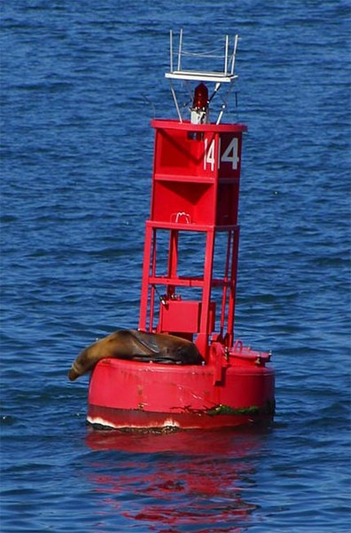
If we used those on the Witches, how would we know if we are coming or going (red, right, return)? Those are used to mark channels, not obstructions. Plus the seal would not be happy here. What about a bunch of these all around the dangerous areas, like the rest of the country uses?:  These are much bigger in diameter and much easier to spot than the spars. When you see a few, you know not to go between them. Combined with our current spars, they would probably make everyone happy and add no ambiguity. |
|
|
|
|
|
08-21-2008, 08:22 AM
|
#7 |
|
Senior Member

Join Date: Aug 2007
Location: South Down Shores
Posts: 1,944
Thanks: 544
Thanked 570 Times in 335 Posts
|
I've often wished that NH would not try to invent its own marker system and go with the standardized navigable waters marker system. The black spars can be especially hard to see in sunlight at times.
__________________
[insert witty phrase here] |
|
|
|
|
08-20-2008, 09:43 PM
|
#8 | |
|
Senior Member

Join Date: Jul 2002
Location: North Kingstown RI
Posts: 688
Thanks: 143
Thanked 83 Times in 55 Posts
|
Quote:
__________________
Gene ~ aka "another RI Swamp Yankee" |
|
|
|
|
|
08-20-2008, 10:40 PM
|
#9 |
|
Member

Join Date: May 2007
Location: Southern NH
Posts: 32
Thanks: 3
Thanked 0 Times in 0 Posts
|
How many trips, seasons of boating do you think it would take if we all took a 5 gallon pail of beach sand and dumped it each time by the Witches to create our own safe haven?
__________________
Just remember Your DEAD alot longer then your ALIVE! Enjoy every DAY |
|
|
|
|
08-21-2008, 08:36 AM
|
#10 |
|
Senior Member
Join Date: Apr 2005
Posts: 103
Thanks: 3
Thanked 27 Times in 8 Posts
|
I think it could be argued that based on the size of the area and the location they should increase the amount of markers around the area.
My opinion.... the problem is that the witches span an area that is bigger than other lake shoals and they are right in the middle of an area that I tell people is like a highway going from weirs to wolfeboro or the broads. There are no roads on the lake but draw a line from the weirs to the broads and beyond and it is like a highway on the weekend, right in that path is the witches. Good thread, I am glad that all sa meredith lost was his/her lunch. |
|
|
|
|
08-21-2008, 09:14 AM
|
#11 |
|
Senior Member
|
The old wood spar markers could weigh 250lbs after getting water logged. The old tapered spar markers were a 14'x8"x8" timber at center, and could really bash in a boat's hull. The new pvc tube spars, about 8'x 6" diameter, weigh maybe 10lbs.
It could be that boaters have learned through observation that hitting one of the new spars will not do any damage to a boat hull. The new pvc spars have enough flotation inside to support a swimmer with his/her shoulders out of the water, sitting on it bicycle style.
__________________
... down and out, liv'n that Walmart side of the lake! |
|
|
|
|
| Bookmarks |
|
|


 Hybrid Mode
