

|
|
|
|
|
|||||||
| Home | Forums | Gallery | Webcams | Blogs | YouTube Channel | Classifieds | Register | FAQ | Donate | Members List | Search | Today's Posts | Mark Forums Read |
 |
|
|
Thread Tools | Display Modes |
 08-02-2020, 06:05 PM
|
#1 |
|
Senior Member
Join Date: Apr 2009
Location: Melvin village
Posts: 524
Thanks: 514
Thanked 315 Times in 149 Posts
|
I give up...Here we go again! Pier 19 store is open and boats we haven't seen before since the store closed are blowing by through the NWZ and on the wrong side of the clearly black and white markers. BAM..BOM...BAM!!!
We and our neighbors try to alert this boaters but they have not clue. One guy as I was waving to him and calling ROCKS!! He and his wife waved back as they destroyed they lower unit. What I don't understand when they hit...they power up which makes it even worst. None of them...none of them stop or even check their props or even more important checking bilge for leakage. These are nice new boats with mostly families on board. This happens several times a week and on weekends I could not give a guess. Are these all rental boats? I have seen some that would not be rentals. Any suggestions what we can do to help warn people beyond what we have done. Several years ago a friend who lives in Wolfeboro place red painted clorox bottles to help identify the rocks. Those didn't last long because the MP came and scooped them up. I think I will just let them slam and bam their boats from now on...so sad to witness.... |

|

|
| The Following User Says Thank You to chasedawg For This Useful Post: | ||
Jdarby (08-03-2020) | ||
|
08-02-2020, 06:33 PM
|
#2 |
|
Senior Member

Join Date: Jul 2014
Posts: 6,317
Thanks: 1,174
Thanked 2,096 Times in 1,297 Posts
|
Are you talking about between Chase and Farm? If so, I saw someone flying through the other day while I was on my jetski and I threw my hands up to warn them as they just cruised through, making it...closely.
Sent from my SM-G950U using Winnipesaukee Forum mobile app |
|
|
|
| The Following User Says Thank You to thinkxingu For This Useful Post: | ||
chasedawg (08-02-2020) | ||
|
08-02-2020, 06:51 PM
|
#4 |
|
Senior Member
Join Date: Jun 2009
Location: Gilford
Posts: 216
Thanks: 6
Thanked 75 Times in 50 Posts
|
The problem is that those coming up from salt water are use to the Red, Right, Returning rule. The Spar navigation rules are unknown to so many and when you try to explain they simply do not listen. How can you change attitude??
|
|
|
|
|
08-02-2020, 07:09 PM
|
#5 |
|
Senior Member

Join Date: Jan 2012
Posts: 2,113
Thanks: 64
Thanked 748 Times in 482 Posts
|
My suggestion is
Chasedawgs Prop and Outdrive Service |
|
|
|
| Sponsored Links |
|
|
|
08-02-2020, 09:20 PM
|
#6 | |
|
Senior Member
Join Date: Apr 2009
Location: Melvin village
Posts: 524
Thanks: 514
Thanked 315 Times in 149 Posts
|
Quote:
|
|
|
|
|
|
08-02-2020, 09:36 PM
|
#7 |
|
Senior Member
Join Date: Feb 2012
Location: Tuftonboro
Posts: 1,243
Thanks: 192
Thanked 329 Times in 239 Posts
|
Saw the same thing last week when paddle boarding. People heading southwest thru there on the left side of the blacks. bam! In all honestly you cant help them. Anyone who cant read or buy a map gets there due. Just like the knuckleheads thats try to squeeze between Farm and the mainland.
|
|
|
|
|
08-02-2020, 09:58 PM
|
#8 |
|
Senior Member
Join Date: Mar 2006
Location: Merrimack and Welch Island
Posts: 4,404
Thanks: 1,360
Thanked 1,633 Times in 1,065 Posts
|
And people want a lighthouse on the Witches where there are relatively few hits !! You need to name it some thing like "Dead Farmer's Gravesite".
|
|
|
|
| The Following User Says Thank You to Descant For This Useful Post: | ||
chasedawg (08-02-2020) | ||
|
08-02-2020, 10:59 PM
|
#9 | |
|
Senior Member
Join Date: Apr 2009
Location: Melvin village
Posts: 524
Thanks: 514
Thanked 315 Times in 149 Posts
|
Quote:
Could I maybe get permission since red floating floats was not allowed maybe attach a flag to the no wake sign that says rocks here pointing down... no rocks the other way slow down!!. |
|
|
|
|
|
08-02-2020, 11:53 PM
|
#10 |
|
Senior Member

Join Date: Apr 2016
Location: In the hills
Posts: 2,420
Thanks: 1,677
Thanked 786 Times in 466 Posts
|
Why worry? Its called natural selection

|
|
|
|
|
08-03-2020, 12:21 AM
|
#11 | |
|
Senior Member
Join Date: Jul 2009
Location: San Francisco/Meredith
Posts: 1,577
Thanks: 675
Thanked 682 Times in 348 Posts
|
Quote:
__________________
Gary ~~~~_/) ~~~ ~~~~~~~~ |
|
|
|
|
|
08-03-2020, 05:49 AM
|
#12 |
|
Senior Member

Join Date: Jan 2006
Posts: 6,759
Thanks: 753
Thanked 1,462 Times in 1,018 Posts
|
I suppose half of them make a wake even if they are on the correct side of the buoy right?
|
|
|
|
|
08-03-2020, 07:07 AM
|
#13 |
|
Senior Member
Join Date: Feb 2012
Posts: 130
Thanks: 321
Thanked 69 Times in 40 Posts
|
I think some video footage so we can all have a laugh. But on a serious note marine patrol should help out in some way I would think. As others have said shame on them for not knowing the markers or having a map.
|
|
|
|
|
08-03-2020, 07:38 AM
|
#14 | |
|
Senior Member
Join Date: Sep 2009
Posts: 554
Thanks: 528
Thanked 316 Times in 156 Posts
|
Quote:
Marine Patrol has helped out in some way, they have installed black markers to warn boaters about the rocks in that area, not much else they can do. Boaters need to be aware of where they are and learn which side to pass markers depending on direction of travel. |
|
|
|
|
|
08-03-2020, 08:13 AM
|
#15 | |
|
Senior Member

Join Date: Aug 2019
Location: Long Island
Posts: 170
Thanks: 137
Thanked 106 Times in 52 Posts
|
Quote:
Im surprised the MP removed them. There are various other examples of these around the lake. Have you contacted the MP and asked them for any suggestions and alerted them to how frequently you witness these strikes? I appreciate you not wanting to turn a blind eye. I dont understand why people cant use a chart or smartphone navigation to know exactly where they should and should not be. With that said, boat damage is a hard way to teach the lesson. But I fear it can translate into serious injury at some point. As you said, people dont even stop to assess damage which defies logic! |
|
|
|
|
|
08-03-2020, 08:38 AM
|
#16 | |
|
Senior Member
Join Date: Sep 2009
Posts: 554
Thanks: 528
Thanked 316 Times in 156 Posts
|
Quote:
"private" markers are not approved on navigable waters across the state. Typically if a "home-made" navigational aid is located it is removed. |
|
|
|
|
|
08-03-2020, 09:15 AM
|
#17 |
|
Senior Member
Join Date: Feb 2015
Location: Tilton/Paugus Bay
Posts: 239
Thanks: 13
Thanked 64 Times in 45 Posts
|
Sad truth is,,,, you can't fix stupid.
If you don't know the area and can't be bothered learning the rules, then the 'play stupid games, win stupid prizes' adage come in. Fwiw, if I do not know an area and the chart is showing all sorts of hell, off plane, trim up, first mate eyes over bow and crawl mode enabled.  Heck first time I saw Graveyard, I veared off and took the long way around. Until the 2nd time when I saw a big cruiser tear through and then I tried it. |
|
|
|
|
08-03-2020, 09:26 AM
|
#18 | |
|
Senior Member
Join Date: May 2006
Location: Texas, Lake Ray Hubbard and NH, Long Island Winnipesaukee
Posts: 2,876
Thanks: 1,037
Thanked 892 Times in 524 Posts
|
Quote:
I think the maps and markers explain things very well through that spot. You however can't make people listen and think. As far as what to do, I think the sad part is there isn't much you can do, except of course as it sounds like you already do, pay attention and if someone ends up in real distress help them out. I am convinced that many people on the lake view their boats as a short term item, that they will trade in after a season or two. This many of them really don't give a darn about the damage they do to them. As an owner of 2 20 year old boats I can't understand the mentality. But it is what it is....
__________________
Life is about how much time you can spend relaxing... I do it on an island that isn't really an island..... |
|
|
|
|
|
08-03-2020, 10:10 AM
|
#19 |
|
Senior Member

Join Date: Sep 2008
Location: MA
Posts: 1,342
Thanks: 757
Thanked 538 Times in 313 Posts
|
No value added to this thread, just wondering if for the various hot spots around the lake where outdrives get crunched, if those big Yamaha Jet boats would go unscathed or would they drag bottom?
Not looking for a solution, just a question out of curiosity. Thanks |
|
|
|
|
08-03-2020, 10:27 AM
|
#20 |
|
Senior Member
Join Date: Mar 2006
Location: Merrimack and Welch Island
Posts: 4,404
Thanks: 1,360
Thanked 1,633 Times in 1,065 Posts
|
Get some good pictures of a really nice wreck, esp at low water, blow it up to poster size and see if you can get it posted at the local store.
I understand why MP is skittish about hoemade markers although in drought years they appear all over the place. An unpainted bleach bottle more universally marks a rock than something red that could be confused with a buoy. Getting inside the rocks to maintain a state marker is problematic, I'd say. We used to see a number of boats going inside FL76; we'd get up and wave. Later we'd just get up and watch. Now we don't even get up. It will be interesting to see how the traffic flows when that side of Farm Island gets developed. |
|
|
|
| The Following User Says Thank You to Descant For This Useful Post: | ||
ApS (08-03-2020) | ||
|
08-03-2020, 10:30 AM
|
#21 | |
|
Senior Member
Join Date: Feb 2015
Location: Tilton/Paugus Bay
Posts: 239
Thanks: 13
Thanked 64 Times in 45 Posts
|
Quote:
Fwiw: My tritoon when not on plane and with the trim up a tad is only about 1.5ft, makes crawling through unknown areas a lot less stressful. 
|
|
|
|
|
|
08-03-2020, 07:56 PM
|
#22 | |
|
Senior Member
Join Date: Mar 2016
Posts: 109
Thanks: 6
Thanked 21 Times in 18 Posts
|
Quote:
But I do approach the lake with caution. Still after ‘learning’ the lake for 5 years, I find the system confusing at best. I think a lot of people get in and hit the throttle and go from there. Some are lucky some aren’t, often never realizing how close they were. I’ve have near misses too. I find the lake to be an entirely different type of boating. This happens in salt too. I see people float thru 2’ areas in Boston all the time and somehow make it by. The fancy new gps screens are awesome but no replacement for basic seamanship and local knowledge. I am having fun learning the lake and so far ...no problems Sent from my iPhone using Tapatalk |
|
|
|
|
|
08-03-2020, 08:47 PM
|
#23 | |
|
Senior Member
Join Date: Aug 2019
Location: Long Island
Posts: 170
Thanks: 137
Thanked 106 Times in 52 Posts
|
Quote:
|
|
|
|
|
|
08-11-2020, 09:22 AM
|
#24 |
|
Senior Member

Join Date: Jul 2004
Posts: 2,985
Thanks: 246
Thanked 744 Times in 444 Posts
|
I cannot fathom how anyone in 2020 would boat over rocks in a power boat. Smart phones are ubiquitous and for less than the cost of lunch for 3 at McDonalds, one can have a year-long subscription to Navionics that will not only tell you where you and rocks are, it will plan a safe route for you to follow. It literally makes the horrible NH ATON system moot.
|
|
|
|
| The Following User Says Thank You to Dave R For This Useful Post: | ||
BoatHouse (08-11-2020) | ||
|
08-11-2020, 06:59 PM
|
#25 | |
|
Senior Member
Join Date: Sep 2008
Location: MA
Posts: 1,342
Thanks: 757
Thanked 538 Times in 313 Posts
|
Quote:
the difference between 18" of draft and 40" is HUGE. I love our Formula out in the open water, but it worries me in a lot of spots. Took some friends by Ellacoya beach recently and forgot how quickly it gets really shallow there. You feel like you are way off shore, but then look at your depth gauge and it reads 3.5' and you realize you need to trim all the way up AND get out of there,,, Dont miss getting beat to death in the old CVX 20 in open water, but some things were never a problem (like navigating the sandbars and the Wolfeboro and the Alton Bridges,,,) 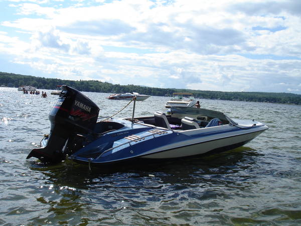
Last edited by XCR-700; 08-12-2020 at 09:00 AM. |
|
|
|
|
|
08-12-2020, 07:46 AM
|
#26 |
|
Senior Member
Join Date: Dec 2009
Location: Foxborough MA
Posts: 176
Blog Entries: 1
Thanks: 4
Thanked 50 Times in 31 Posts
|
Unfortunately some people do not pay attention when piloting a boat. The Lake is very tricky and being aware of the direction you are traveling is a must. The buoys Do Make Sense if you take the time to understand which way you should go. First you need to know your course North, South, East, West.(get a compass). The markers Black Top Spar: you pass NORTH of it when your course is East/West. you pass EAST of it when your course is North/South. Red Top Spars: you pass SOUTH of it when your course is East/West. you pass WEST of it when your course is North/South. I have a few tricks to help me remember. NEWS: BLACK is alphabetically before RED. BLACK you go NORTH or EAST.
RED you go WEST or SOUTH. Hence NEWS. Also it is always hot (Red) in the South and West, and it is Cold (Black) in the North and East. I am old school and don't have electronic navs available to me. Buy a CHART and study it. It will be your friend and understanding will be easier. Good Luck ALL and don't forget to be aware of the NEWS!! |
|
|
|
|
08-12-2020, 08:40 AM
|
#27 | |
|
Senior Member

Join Date: Jul 2005
Location: Berlin, Ma / Gilford
Posts: 1,934
Thanks: 450
Thanked 605 Times in 341 Posts
|
Quote:
These spots were all identified in an old thread here which I could not find to reference. Below is a perfect example -- no one in their right mind should ever split between 2 Black Tops ……. yet it is the proper/safe route.
__________________
A bad day on the Big Lake (although I've never had one) - Still beats a day at the office!! |
|
|
|
|
| The Following User Says Thank You to Phantom For This Useful Post: | ||
ursa minor (08-12-2020) | ||
|
08-12-2020, 12:26 PM
|
#28 |
|
Senior Member
Join Date: May 2004
Posts: 962
Thanks: 495
Thanked 274 Times in 175 Posts
|
At the southeast tip of Bear Island, the red top buoy near the black top buoy shown is this section of the Bizer chart is quite close to shore. The sailing line is through this narrow passage. Frequently, boats come through this passage on plane as they are headed around the island tip and continuing on west towards the Weirs.
When we are headed east, and then north on our way to our place on East Bear Island, we stay well south of the island's tip until we can see if any boat is coming south through this narrow passage. Also, we proceed with caution when we are headed south and west in this location. Double-flashing lighted buoy #30 (and black top buoy) is so located so it can be seen from several locations as boats head east and west, and north and south. I believe that it also marks a shallow area. Last edited by Barney Bear; 08-12-2020 at 12:36 PM. Reason: Info added |
|
|
|
|
08-12-2020, 12:48 PM
|
#29 |
|
Senior Member
Join Date: Mar 2006
Location: Merrimack and Welch Island
Posts: 4,404
Thanks: 1,360
Thanked 1,633 Times in 1,065 Posts
|
In the same section of chart posted above, note the two red tops at the south end of the channel between Mark and Mink. Go between them.
|
|
|
|
|
08-12-2020, 01:08 PM
|
#30 |
|
Senior Member
Join Date: Mar 2008
Location: Bear Island/Merrimack
Posts: 807
Thanks: 58
Thanked 203 Times in 130 Posts
|
We see people go between Mark and Bear right through the middle all the time (north of marker 29). People don't realize there are rocks and they don't know to stay between the markers near Mark. I can only remember seeing one boat hit a rock in there but my neighbor said she saw someone hit this week. You better not make that mistake in September-October when the lake is lower.
|
|
|
|
|
08-12-2020, 02:15 PM
|
#31 | |
|
Senior Member

Join Date: Aug 2010
Location: Tuftonborough & Franklin MA
Posts: 265
Thanks: 99
Thanked 143 Times in 64 Posts
|
Quote:
__________________
" Any day with a boat ride in it is a good day" |
|
|
|
|
|
08-12-2020, 02:38 PM
|
#32 |
|
Senior Member
Join Date: Jan 2012
Posts: 2,113
Thanks: 64
Thanked 748 Times in 482 Posts
|
If one follows the dotted green lines in the chart posted above the rocks will be safe from the props.
|
|
|
|
|
08-12-2020, 02:51 PM
|
#33 | |
|
Senior Member
Join Date: Jul 2005
Location: Berlin, Ma / Gilford
Posts: 1,934
Thanks: 450
Thanked 605 Times in 341 Posts
|
Quote:
__________________
A bad day on the Big Lake (although I've never had one) - Still beats a day at the office!! |
|
|
|
|
|
08-12-2020, 02:54 PM
|
#34 | |
|
Senior Member
Join Date: Aug 2019
Location: Long Island
Posts: 170
Thanks: 137
Thanked 106 Times in 52 Posts
|
Quote:
|
|
|
|
|
|
08-12-2020, 03:18 PM
|
#35 | |
|
Senior Member
Join Date: Mar 2008
Location: Bear Island/Merrimack
Posts: 807
Thanks: 58
Thanked 203 Times in 130 Posts
|
Quote:
|
|
|
|
|
|
08-12-2020, 09:16 PM
|
#36 |
|
Senior Member
Join Date: May 2004
Posts: 962
Thanks: 495
Thanked 274 Times in 175 Posts
|
The east red top buoy at the south end of the channel between Mark and Mink Islands noted in Item #29 above is still missing. I have called Marine Patrol several times concerning this missing navigation marker, but, alas, it continues to be missing. This area south of Mink Island is shallow and should have its buoy back. 🐻
|
|
|
|
|
08-12-2020, 09:40 PM
|
#37 |
|
Senior Member
Join Date: Mar 2006
Location: Merrimack and Welch Island
Posts: 4,404
Thanks: 1,360
Thanked 1,633 Times in 1,065 Posts
|
If you are on the chart or GPS, you should know where to go whether the buoy is there or not. Been running around the lake with missing buoys almost every spring for many years. You need to know wheere you are with a compass and chart not electronics.
|
|
|
|
|
08-13-2020, 09:09 PM
|
#38 | |
|
Member
Join Date: Apr 2020
Posts: 29
Thanks: 5
Thanked 21 Times in 14 Posts
|
Quote:
Or not, however, if it's something they do frequently it would save them the purchase of a separate GPS for boating. |
|
|
|
|
|
08-13-2020, 10:26 PM
|
#39 |
|
Senior Member
Join Date: Jan 2012
Posts: 2,113
Thanks: 64
Thanked 748 Times in 482 Posts
|
I use Navionics to plan my salt water trips.
Using the Active Captain app I can transfer the routes and waypoints to my trailer boat's Garmin gps. That boat is seldom used in fresh water so I have not purchased the inland waters data card. If my iPad had a screen that could be read in bright sunlight I would use it on the lake. For now, the lake boat has no gps so I use the waterproof chart. |
|
|
|
| The Following User Says Thank You to 8gv For This Useful Post: | ||
Barney Bear (08-14-2020) | ||
|
08-13-2020, 10:45 PM
|
#40 |
|
Senior Member
Join Date: Mar 2016
Posts: 109
Thanks: 6
Thanked 21 Times in 18 Posts
|
So something that came into play tonight. Obviously more obvious during the day. I ran for a lit buoy...only to come up on the actual buoy floating about 10 away. I had time to negotiate it but I had to get pretty close to see the actual buoy.
On salt...a lit is a lit and something to be used as an actually ATN Sent from my iPhone using Tapatalk |
|
|
|
|
08-14-2020, 12:33 AM
|
#41 |
|
Senior Member
Join Date: May 2004
Posts: 962
Thanks: 495
Thanked 274 Times in 175 Posts
|
The lighted buoys have a colored top buoy very near them to indicate how to navigate at this location. 🐻
|
|
|
|
|
08-14-2020, 09:01 AM
|
#42 | |
|
Senior Member
Join Date: Jul 2004
Posts: 2,985
Thanks: 246
Thanked 744 Times in 444 Posts
|
Quote:
|
|
|
|
|
|
08-14-2020, 10:02 AM
|
#43 | |
|
Senior Member
Join Date: Feb 2015
Location: Tilton/Paugus Bay
Posts: 239
Thanks: 13
Thanked 64 Times in 45 Posts
|
Quote:
The ones that get me are the black ones wayyyyy off shore with no companion. In pitch black, even if you watch charts close, you could easily bonk one. I know of 3 in Merideth Bay that made me go  first time I saw them up way too close. first time I saw them up way too close.
|
|
|
|
|
|
08-14-2020, 12:23 PM
|
#44 |
|
Senior Member
Join Date: Feb 2015
Location: Tilton/Paugus Bay
Posts: 239
Thanks: 13
Thanked 64 Times in 45 Posts
|
Playing with night vision last night, here is an example of a lighted/companion.
https://www.youtube.com/watch?v=443NXnfWLlk Not one of the aforementioned 3 single black spars, but an example of lit and companion as per base note. |
|
|
|
|
08-14-2020, 12:28 PM
|
#45 | |
|
Senior Member
Join Date: Mar 2016
Posts: 109
Thanks: 6
Thanked 21 Times in 18 Posts
|
Quote:
The gap actually looks more than 10. Is the buoy attaches to the light underwater? Sent from my iPhone using Tapatalk Last edited by persistence; 08-15-2020 at 01:18 PM. |
|
|
|
|
|
08-14-2020, 02:21 PM
|
#46 | |
|
Senior Member
Join Date: May 2006
Location: Texas, Lake Ray Hubbard and NH, Long Island Winnipesaukee
Posts: 2,876
Thanks: 1,037
Thanked 892 Times in 524 Posts
|
Quote:
__________________
Life is about how much time you can spend relaxing... I do it on an island that isn't really an island..... |
|
|
|
|
| The Following User Says Thank You to LIforrelaxin For This Useful Post: | ||
garysanfran (08-14-2020) | ||
|
| Bookmarks |
| Thread Tools | |
| Display Modes | |
|
|


 Linear Mode

